Sunday, December 22, 2013

Stuart Peak Double-Take

Take one (December 7): 

Two weeks ago Saturday I had a go at Stuart Peak. The high at 7,000 feet (1,000 feet below the summit of Stuart Peak) was -15 degrees with wind chills predicted to be in the -40s. The weather was predicted to be stable, clear and cold!

I made good time, covering the first 4.5 miles in about 1.5 hours. There was 1-2 inches of snow on the ground up to the that 4.5 mile mark. The snow depth increased rapidly from that point (~5,000 feet) up. I donned my snowshoes at about the 5 mile point and began the slog!

The temperature, although in the -10s, was bearable. On my feet I sported two pairs of wool socks stuffed inside of boots rated to -20 degrees. My legs were covered with two pairs of long-underwear under light trekking pants. On my upper body, I wore 4 layers underneath a winter parka (down mittens with over mittens on my hands). And finally, on my noggin, I wore a balaclava, a fleece neck warmer and a beanie.

Labored breathing laden with the moisture of my breathe froze instantly on any  surface within 7 inches of my mouth. Fortunately, the approach to Stuart Peak lies in a well protected gully, making the wind a non-issue for the first 5-6 miles.

That said, the strong winds combined with the snow of recent days resulting in a 2-3 inch crust on top of 6-8 inches of fairly light powder snow. The crust was weight-bearing 5% of the time: slow-going. Every step required patience as I broke through with each snowshoe and regained purchase on the packed powder beneath the crust.

6.5 miles up, the trail rounds a corner providing the first view of Stuart Peak. With the turn of the corner came the first encounter with a bitter wind in the -30s. The last time I felt winds that cold was in Great Falls  in 2008 when I would go for long runs in -20 to -30 wind chills (this required goggles and 0% skin exposure).

I continued slowly for another 150 feet breaking through the crust, gaining traction and taking another step. At such a frustratingly slow pace, I had another 2-3 hours to the summit, which meant another 3-4 hours exposed to the brutal wind that was increasing in strength and decreasing in temperature. I stopped to assess the situation: the tips of my right toes were getting pretty dang cold and required frequently 'wiggle-stops'; exposure to the wind/cold was only to increase over the next 3-4 hours and the wind roared overhead! Uninterested in frostbite in such a low-reward scenario, I opted to make this point (~6800 feet) the day's high point. I snapped a picture and headed down to the warmth (-8!). This trip goes down as the first time in 5 years that I have not seen another soul in the Rattlesnake (on the trail or at the trailhead).

Self-portrait at the high point on 'take one'.
Take two (December 14):

Exactly a week later - and 25 degrees warmer - I came back with a secret weapon: fellow Rockturnal, Lydia Hess. Fueled by Bernice's Coffee and a touch determination, we hit the trail around 7:30AM. 

Since my last trip a week before, about 6 inches of snow had fallen in Missoula and 1-2 feet higher in the mountains. I was glad to have snowshoe packed what there was of a trail up to the 6.5 mile mark a week before.

Lydia and I moved swiftly, hitting the 4-mile point in about 1.5 hours. About a half-mile later, we donned our snowshoes and enter into a pleasant amble through 6 inches of fresh powder. A mile further the snow's depth was closer to a foot on top of the previously packed trail. Accordingly, our pace slowed. 

By the time we reached my previous week's high point and the end of the snowshoe-packed trail, the snow was closer to 18 inches on top of the old trail. The end of the snowshoe-packed trail meant the end of the easy 'cruise' up Stuart Peak. One step beyond the previous week's high point resulted in a snowshoe-post-hole through 12-18 inches of powder onto (and through) a weak 2-3 inch crust and down to the next layer of firmer snow where purchase was final achieved. 

A slice of humble pie! Our pace slowed from 3-4 miles/hour to less than 1. With 2 miles remaining to the summit of Old Stuey, we had a long slog ahead of us. We trudged on, route-finding to the best of our ability, eventually stumbling upon the Wilderness Boundary marker. 

We stopped for a brief snack break at the Wilderness boundary marker. Now in a cloud with 100-200 feet visibility and a 1.5 mile slog ahead of us to the summit, it was all business. We trudged on!

The snow remained consistently inconsistent: powder, crust, firmer snow. We post holed 1-2 feet with every step (likely waist deep without snowshoes!). As for route-finding, thrown off by the slow pace of travel and assuming we were further along the southeast ridge of Stuart Peak, I (I will take credit for this mistake) moved us onto the crest of the ridge too early, resulting in a disorienting, circuitous approach to the summit ridge. At one point, Lydia protested "are we walking in circles!?". She was angry or upset, she had a valid question, and as we came to discover on our way down, for good reason! 

So I (again, Lydia had her senses) led us in semi-circles, combing the ridge for any sign of the drop from the southeast ridge to the summit ridge. Just when I was beginning to give up hope that we would find it with such poor visibility it appeared: a sharp change in the slope up the south ridge! 

We stopped at the base of the summit ridge for about 1-minute to assess our situation, sort of a council of war (we were moving slowly and we needed to get back by 4:30PM (it was 12:15PM). We decided to go for it and finish what we had worked so dang hard for: the summit!

Fortunately, as anticipated, the crest of the south ridge being exposed to some very strong winds was pretty dang firm in spots. Although, we soon discovered the truth...consistently inconsistent snow pack. Onward and upward!

Lydia and I hit the final summit slope with a seriously strong 'let's get this done!' sort of push and landed on the summit around 12:45PM. We killed it! 30-minutes for that final 1/2 mile steep push. 

We exchanged fist bumps, took the obligatory summit photo, honored the fact that we were inside of a cloud and had no view whatsoever, felt the cold/wind and got the heck out of there (we spent 3 minutes on top!). 

On the summit of Stuart Peak!
In an effort to get ourselves warmed up and get back by our self-imposed timeline, we made quick work on the descent. Thanks to our work snowshoe packing the trail and with the steady pull of gravity this took little effort.

The descent was uneventful, save for meeting up with 3 telemark skiers 3/4 mile from the summit (they had followed our tracks from the bottom!).We took one break on the way down to remove our snows at the 4.5 mile mark and soldiered on, making the total descent in about 3 hours. Wahoo!

Onward and upward,

Brian

Saturday, November 30, 2013

Searching for Winter: Rattlesnake trip report (sometime recently)

Mountains: Stuart Peak, Mosquito Peak, Stuart Peak (Rattlesnake Wilderness)
Distance: ~22-23 miles (round-trip)
Vertical feet gain: 6520 feet
Total elapsed time: 9 hours 5 minutes (6:12AM - 3:17PM ~20 minutes of breaks) 

The office life has never suited me. It is very likely that the office life has never suited anyone. Although my job can be immensely rewarding, it is, at the end of the day, an office job on the top floor of a somewhat stuffy building that lacks ventilation and adequate windowage. The net result of all of this - the full-time office life - breeds an intense desire for outdoor adventures.

With a mild fall and a reluctant winter, my outdoor adventure focus over the last few weeks has shifted to searching for winter. To the high country!

Sometime recently:

6:12AM: I left the warmth of my car at the Main Rattlesnake Trailhead - ~4,000 feet - for the chill (~10-15 degrees) of the morning. The trailhead was snow-free, as was the trail for the first 5 miles. The Missoula area had had a few good snowfalls in the high country over the last couple of weeks which was followed immediately by a cold front that froze the landscape in time. I planned accordingly and was equipped with snowshoes, crampons and ice ax, and full winter outerwear. 

I traveled by headlamp for the first 1 1/2 hours. Three hunters on bikes passed me on the Main Trail - my last signs of human life for 7 hours -  around 6:20AM. I took advantage of the dry trail and traveled swiftly (~3-3.5 miles/hr) in the predawn light. 

~8:00AM: Snow! At around 6,000 feet the snow began. At first a hard, frozen crust of an inch or two, boot-packed well by what had likely been hunters, grew steadily with every step to 1-2 feet at the Wilderness boundary (~7 miles in). About 1/2 mile after the Wilderness area began, with an increasing snow pack and a less well-traveled trail, I donned my snowshoes. A few minutes later, I left what was left of the boot-packed summer trail and opted to route-find my way up the trail-less south slope of Stuart Peak.

8:45AM: More snow! As I continued up the mountain, the snow pack increased to 4 or so feet. With snowshoes, I was impacting no more than 6 inches with every step. The consistency of the pack - powder snow on a hard crust - made for easy, rhythmic travel. Beautiful!

9:08AM: The Summit of Stuart Peak!
An excited self-portrait on the summit of Stuart Peak with
Mosquito Peak, the next objective, over my left shoulder.

~9:25AM: I left the glorious summit of Stuart Peak for Mosquito Peak. Per usual, I disregarded any of the summer trails and kept a tight line on the ridges. Oh, the joys of winter travel!

~10:30AM: I arrived at the foot of the summit ridge of Mosquito Peak after a nice slog over the long rolling connecting ridge between Stuart Peak and Mosquito Peak. I impacted about 6-12 inches with every step, but kept a steady, if somewhat slow, continuous plod. At the base of the summit ridge, I exchanged my snowshoes for crampons and trekking poles for my ice ax. 

The summit ridge of Mosquito Peak. My track is visible on the ridge.
This shot was taken on my way back to Stuart Peak.
Looking down the summit ridge to a false summit of Mosquito Peak.
Here,without snowshoes, I was postholing 1-2 feet with every step.

11:06AM: The summit of Mosquito Peak! Remarkably and entirely coincidentally, I arrived on the summit of Mosquito Peak exactly 2 hours after Stuart Peak (~1 hour, 35 minutes from the time I left Stuart for Mosquito).
Self-portrait #2 of the day on top of Mosquito Peak.
That expression, again, is a cry of joy, not pain.

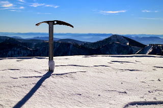
My ice ax planted on the summit of Mosquito Peak with Stuart Peak right of center.
I spent less than five minutes on the summit of Mosquito Peak before heading down to my snowshoe, extra gear and trekking pole cache. Upon donning my snowshoes and repacking my gear, I slogged my way up and down the rolling ridges back to Stuart Peak.

~12:45PM: Back on top of Stuart Peak!
Self-portrait #3 and final picture of the day on top of Stuart Peak again.
Mosquito Peak (form whence I came) is visible over my right shoulder. 
It would be untruthful of me to suggest that I was nothing, if not tired, on the second trip up Stuart Peak. I was tired, but no less elated to be out on one of the most beautiful days in recorded history. And, about to walk 8.5 miles downhill! Yahoo!

The trip back to the trail head, although uneventful, was extremely enjoyable and relaxing. I cruised downhill, turning the 2 hour 56 minute ascent into a 2 hour 20 minute descent.

3:17PM: Back at the trail head!

All told, the outing was exactly what I was searching for: an escape from office life and the discovery of winter! I felt and feel incredibly blessed to be afforded opportunities to experience God's beauty and the accompanying peacefulness. I always come back after trips like this a little better than I left. A new creation!

Onward and upward!

Brian

Saturday, November 9, 2013

Mount Sentinel Hill Climb: Race Report

"There's a long line of cars/And they're trying to get through" Cake
A day late, a buck short. I apologize for the delay on the Mount Sentinel Hill Climb race report. A week or more past, I drafted up a pretty lengthy report only to have my computer freeze and ultimately lose the blog post.

Take two:

Linds took this picture moments after the start of the race from the bottom of the course.
I am visible with a yellow hat and black long-sleeve shirt.
The Mount Sentinel Hill Climb is an all-out effort race up Mount Sentinel's 2,000 vertical feet by way of 2 trails: the shorter and steeper northwest ridge and the longer, but gentler 'M Trail'. All runners are required to take the 'M Trail' to the giant cement-casted 'M' about 1/3 of the way of the mountain. At the 'M', runners are presented with the option of continuing on the gentler 'M Trail' or power up the steeper northwest ridge trail. With a previous PR of 24 minutes and 30 seconds on the length of the northwest ridge trail, I didn't know what to expect with the added distance of the 'M Trail' up to the 'M'.  This was a chance to find out!

Around 9:55AM on the morning of the race, 100 runners self-selected positioning and crammed themselves into the starting channel leading up to the entrance of the 'M Trail'. Although by trail standards the 'M Trail' is broad, it, at widest, can accommodate 2.5 adults shoulder-to-shoulder. I positioned myself roughly a third of the way back. Knowing I would not be running a step of the race, I opted for a comfortable placement that wouldn't impede passage of the swift mountain runners.

At 10AM the gun went off. It took a good 15-30 seconds for the front third of the pack to clear out and get moving up the trail. As spaced opened up, runners to my left and right began to first slowly walk, then walk swiftly and finally run! I was able to open up my power-hiking stride within the first 15 feet and finally get to work doing what I love best: moving swiftly in the mountains.

The longest and most gentle switchback of the entire route occurs first. Although crowded, there was enough space to somewhat gracefully move through the runners. At the turns of the first couple of switchbacks the pace expectedly slowed to a walk as the group made the turns. The first leg up to the 'M' proved a game of leapfrog with runners. On the steeper switchbacks I would pass 3-4 runners who in turn would pass me on the gentler switchbacks when they got back up to a solid running stride.

By the time I got to the 'M' runners had more or less settled into their pace/position for the race: a dozen or so in front of me and 80 or so behind me. I passed in the 'M' (620 feet off the valley floor) feeling strong, beaming brightly and enjoying myself thoroughly! I have no idea how much time had elapsed to get up there and frankly I didn't care. I was having a blast.

A few feet passed the 'M' the course splits: northwest trail or 'M Trail'. This was a no-brainer for me. I live for the northwest ridge trail!

I passed a few more folks on the middle portion of the mountain on the northwest trail as runners began to slow to a power-hike on the steeps. My approach with power-hiking, as it was with marathons and ultra-marthons, 'swift and steady'. I passed my last runner at about the halfway point. From there, I slowly closed in on the guy in front of me, only to have him pull away on the few gentler sections of the northwest ridge trail.

In this manner, the upper half of the mountain proved to much like any of the other 50+ times I had used this route as a training ground in the last year. Again, beaming, I accepted my place and smiled my way up to the final summit ridge of Mount Sentinel.

As I crested the ridge and the slope lessened to the summit, the finish line archway and clock came into view. The clock read 25 minutes and 40-some seconds. I was tempted to run in the last bit and see about getting under 26 minutes, but opted to stick to my guns and keep to my power-hiking race. I quickened to a power-walk and hit the finish line at 26 minutes and 32 seconds. Having never timed myself before utilizing this exact route (the 'M Trail' to northwest ridge trail route), I had nothing to compare it to and decided only to be pleased that I had had such a great time and had set a new PR.

Curious as to how the race unfolded, I checked the results later in the day to find out that I came in 14th place. The winners, elite trail runners, made it to the top in under 21 minutes! Amazing. All told, I am very pleased with my performance (I won't pretend I am not competitive) having not run a step of the race.

I had a blast and loved the low-key, local nature of the race. I will be back next year!

Onward and upward,

Brian

Tuesday, October 15, 2013

Rheumatoid Arthritis, cookies and mountains

"Is there truth, in your pain, you decide" Dashboard Confessional
Rheumatoid Arthritis: 
Bad news: still have it
Good news: not as badly

Cookies:
Today, I ate two cookies. Yesterday, I ate three (smallish cookies). Currently, my favorite cookie is whatever Connie Dillon is baking (soon to change, 'The Letter K' is coming to town this week).

Mountains:
The text gadget on the right is not working. Consequently, I have not been able to update the project stats for a couple of weeks. Here are a few cumulative states updated:

Total vertical feet in 2013: 339,000
Mount Sentinel summits: 111
University Mountain: 26

On Sunday, October 27th, I am going to race - power hike, not run - the Mount Sentinel hill climb. I am pretty pumped to race again. The last race that I sunk my teeth into was the Elkhorn 50 miler in 2009. It ended disappointingly with a 'did not finish' and resulted in the first string of medical visits that led to the RA diagnosis in 2010. At this stage, it is all about doing the best that I can do within my physical means and delight in the fact that I am able to do what I love: go up mountains.

Onward and upward,

Brian

Tuesday, October 1, 2013

Mount Sentinel: Double or Nothing

Total vertical ascent: ~4,000 feet
Total distance: ~5 miles
Total elapsed time: 1 hour 25 minutes 40 seconds
First round trip: 41 minutes 27 seconds
Second round trip: 44 minutes 13 seconds 

Sometime back in the April or May - probably May, I had the vision for an all out double effort on Mount Sentinel. Two back-to-back round trips to the summit power hiking - no running - in an all out effort. Unfortunately, summer came on quickly, delaying the outing: my body seems to be at its best in terms of sustained exertion in the 40s-50s. Yesterday, it struck me that tomorrow (today) was the day! My body felt strong and the weather had finally become relatively stable. Go time!

I fueled up with a Clif Shot Blok jelly on my way to the trailhead, cued AWOLNATION on my iPod and set my timer. I went pretty hard and probably looked ridiculous as ever to all of the other hikers on the trail: trekking poles flailing, legs akimbo. So it goes...and so I went!

The first ascent was improbable. Improbable in the sense that I was killing myself on the first ascent, way too fast. I knew what I was doing and by that I mean I was clueless, save for the fact that I knew I had the entire descent to recover for the second ascent. Diminishing returns...and so I continued!

I pushed hard for the first summit and failed to get my split on the summit, but I put it at around 24:30ish based on my descent times and second round trip. I tagged the summit and hauled butt down, doing everything in my power to not run a step. Instead, I power walked with a low-center-of gravity, again looking quite silly I'm sure.

The first descent went without a hitch. I popped a couple of Shot Bloks on the way down when my body was ready to receive it. As I got back to the parking lot, I checked my split: 41 minutes and 27 seconds. I was beside myself! My previous PR on that trail for the year was in the 45-46 minute range. I felt strong and ready for another go (and somehow the AWOLNATION album I was listening to restarted. So, you know, it was go time). I grabbed a 7-10 second drink of water at the drinking fountain and hauled butt back onto the trail.

The first 1/3 of the second round trip was rough. My legs felt dead and I wasn't sure if I was moving quickly or not. In my mind, I was flying, but somehow, in reality, it didn't seem so. And so I persisted. About halfway up, something clicked and strength returned: I begin finding rest on the gentler slopes. About 2/3 of the way up I passed a guy that I had passed on the way down on the first round trip. He commented, "You are making this old guy look bad". I responded, "Well sir, I am not feeling so good". Which was true and honest and all of that. It was at that time that a slight nausea set in. With roughly 600 feet to go, the end was in sight and it wasn't difficult to push through the feeling of sickness, knowing that the sooner I got to the summit, the sooner I would be resting again on the descent.

I pushed hard on the last ~200 vertical feet, leaving nothing on the table. Which felt good mentally, but not so good physically! Not in a damaging sort of way, but in a sickness sort of way. Fortunately, I never lost my lunch or Clif Shot Bloks. I hit my split on the summit: 1 hour 8 minutes 36 seconds. Whoa! I was extremely surprised. Mostly that I hit a 27 minute 9 second second round trip. It felt like hours!

Eager to feel better, I quickly began my descent. Within a couple of minutes, the nausea subsided enough to take my final Shot Bloks. Honestly, I brought these less because I needed them and more because they are freaking delicious (thanks Phil!). I am snacking on them as I write this in the comfort of my home. Anyways, I moved swiftly and steadily downhill to the final track of AWOLNATION's 'Megalithic Symphony' eager to click stop on my watch. I smiled at the 'old guy' as I passed him for the second time on the way down.

I hit the trailhead for the second time and stopped my watch: 1 hour 25 minutes 40 seconds. Whoa! I was beside myself. I was really hoping for under two hours and after the first round trip settled on the 1:30-40 range, but this. It was nice to be surprised! Very nice.

And so hear I sit, writing about something that happened 2 hours ago and means little to anyone else. Truthfully, it means only un poco to me. Life is about living and this is one way to live. It includes meaningful relationships, fulfilling work, a healthy soul, love and ambitious, enjoyable goals. I had a blast and hope that everyone else is finding their Mount Sentinels these days!

Onward and upward!

Wednesday, September 18, 2013

Some days the mountain leans back

Some days the mountain leans back, lies down gently and grants those who venture onto its slopes ease of travel. The trail appears a nearly horizontal traverse, whose view magically sweetens with each step;
On certain days the mountain lies in repose, as if to say, "today, I will rest and bear the burden of your sojourn". Continuing, the mountain adds, "consider this your rest and enjoy the journey".
On several occasions this year - and countless throughout my life - I have had moments in the mountains where the mountain has the appearance and the feeling of 'leaning back' and lessening its slope's angle. This may be an illusion: whose to say that the lower slope angle is not the norm and on most days the slope has the appearance and feeling of being steeper.

It is probably all an illusion! What is measurable and constant is the slope's actual angle. My favorite trail on Mount Sentinel rises about 2000 vertical feet in 1.2 miles, a fairly steep trail. As a rule, this particular trail's required effort seems commensurate with its steepness. But on certain days - and today was one of these - the mountain truly has the appearance of lying back and lessening its slope angle, allowing for a less intense effort that yields the same results.

The reason(s) for this phenomenon (and that's a stretch) may seem obvious: variables in daily diet/hydration, sequence in a work out cycle, mood, time constraints, etc. All of these things certainly play a role in overall fitness and point-in-time health and performance, but do not explain the visual appearance of the slope.

Today, the trail presented itself modestly, looking half itself while providing fully rewarding pleasant and easy passage. And I will examine no further.

Thank you, mountain.

Onward and upward,

Brian

Monday, September 16, 2013

300,000 feet and Mount Sentinel

A  quiet moment for a fellow hiker on top of Mount Sentinel.
Today's 96th ascent of Mount Sentinel on the year, marked the 300,000 vertical foot milestone for 2013.

Ascent: 27 minutes
Descent: 28 minutes
Temp: ~82 degrees
Music: Vampire Weekend 'Modern Vampires of the City' and Sigur Ros 'Untitled'
Highlight: Finding my lost bike lock key hanging on the fence at the base of mountain Sentinel upon coming down the mountain.

That is all. Onward and upward!

Brian


Sunday, September 8, 2013

24 Hours of Sinopah Mountain (in pictures)

Linds and I made our way up to Glacier National Park for an extended Labor Day Weekend. Over the course of 3.5 days we hiked over 40 miles of the park, logging over 9,000 vertical feet. Glacier did not disappoint! What beauty! Our last night in the park was spent at Two Medicine Lake in the southeast corner of the park. The inclement weather of the previous two days beginning moving out, providing some super cool changes in light.

The following pictures were taken during a 24 hour period at Two Medicine Lake (shown in the order that they were taken). The model? Sinopah Mountain!


Onward and upward!

Saturday, August 17, 2013

Trip Report: Point Six and Murphy Peak

Trailhead: Snowbowl Ski Area parking lot (~5,000')
High Points: 'Point 7500', 'Point Six' (7942') and 'Murphy Peak' (8167')
Total Elevation Gain: 5,000 feet
Duration: 3 hours 23 minutes (round trip)

I got onto the mountain around 8AM via Snowbowl Ski Area. Although there is an established trail to the top of the Ski Area (~ 4 miles), I opted for the most direct route to the top of Snowbowl. From the top of Snowbowl, point 7500, I would then head up to 'Point Six' and finally 'Murphy Peak' by way of the connecting ridge between the two (and then a reversal of the route).

Looking south/southwest from the top of Snowbowl
(parking lot lower left)
Departing at 7:55AM from the parking lot, I followed the 'Runout' run for the first 3/4 of a mile before taking a hard left up a steep glade run on the crest of the rib that marks the western edge of 'West Bowl'. The line provides a direct shot to the top of Snowbowl. By this route, I bushwhacked my way through knee high vegetation interspersed with beautiful coniferous trees. About 700 feet below the summit, lush undergrowth gave way to an expansive talus field - rocks roughly the size of basketballs or larger. What a treat! It provided, without exception, a stable, direct and swift passage to the top. Within a few minutes of discovering the talus 'super highway' I was on top of Snowbowl Ski Area. I was very pleased to see that the clock read 8:39AM, about 45 minutes from bottom to top.

From Snowbowl, I headed northeast via a ski run to the broad connecting ridge to Point Six. I opted for the most direct ridge road. A few minutes later I was standing amongst the radio towers and doppler radar that is Point Six. There I encountered a woman walking around the summit taking photos. She explained that she was with a crew that had driven up to Point Six to do some repair work on the HAM radio setup. We both made remarks about the beauty that surrounded us from our lofty perch above Missoula and the Rattlesnake Wilderness. I suggested that on the clearest day, Flathead Lake might be visible from this vista. Unsure of the veracity of this, she responded "maybe" and I concurred as I rethought the possibility of Flathead Lake actually being visible from this far south.

Looking north to Murphy Peak from Point Six
(Murphy Peak is the high point right of center)
After parting ways with the HAM radio enthusiast, I took a 1-2 minute break on the summit of 'Point Six' to mix an electrolyte drink mix and pull out a granola bar for the road. Feeling strong and fired up about the next objective, Murphy Peak, I dropped down the boulder field that defines the north shoulder of Point Six. Point Six and Murphy Peak are connected by a roughly two mile-long undulating ridge that dips down to 7500' with one prominent point on the ridge between the two named peaks. Amazingly, just above saddle between Point Six and the prominent ridge point ahead, a wilderness registration box materialized. Seemingly in the middle of nowhere with no real defined trail it was somewhat baffling. I quickly registered and followed what appeared to be more of a game trail than a manmade hiking trail. "Hey Bear! Hey Bear!" was my loud, audible mantra for the day (I did not so much as see bear scat). After about 1/2 mile I lost the game trail and headed for the crest of the ridge. Within a few minutes, I found myself on top of the prominent point that marks the halfway point between Point Six and Murphy Peak.

Self-portrait looking north on Murphy Peak
I let out a joyful 'Whoop!' as the next expanse of ridge opened up between myself and Murphy Peak's summit. The ridge narrowed and, at times, steepened amidst a jumbled mess of massive granite slabs. It looked super fun!

I quickly made my way down the ridge point to the final little saddle that marks the beginning of the summit cone of Murphy Peak. I stashed my trekking poles about 400 feet below the top as the ridge steepened and forced some quick and easy scrambling moves. A final move through a narrow slot in the rock gave way to the final talus field of Murphy Peak. Moments later I was standing on top with joy in my heart! The clock read 9:39AM, exactly one-hour after getting to the top of Snowbowl and 1 hour and 45 minutes from my car. I was extraordinarily pleased with this time, as I was aiming for something of a lung/quad-busting speed ascent.

I took a 3-5 minute break on top of Murphy Peak to rehydrate, take some food and electrolytes and snap some photos as well. It was so dang pretty up there! The panorama included a view of the Rattlesnake Wilderness, Missoula, the northside of Snowbowl, Point Six, the southern reaches of Arlee, the southern end of the Mission Mountains and the Grant Creek complex.

Hydrated and nourished, I donned my pack and began the long retrace of the connecting ridge back to the top of Point Six and down to the SnowBowl Ski Area. I did my darndest to retrace my line down Snowbowl. About 1/3 of the way down, I saw a mountain biker athwart my direct descent, enjoying a leisurely solo cruise in the mountains. Beautiful stuff. I regained the runout on the bottom 1/3 of the mountain and cruised on down to the parking lot. I arrived at my car at 11:18AM. Gosh, still morning! what a nice surprise.

Overall, this route goes down as one of my favorite local hikes. The connecting ridge between Point Six and Murphy Peak is pretty dang fun and the views from atop those two high points are spectacular.

Onward and upward,

Brian

Saturday, August 10, 2013

July in review and lessons learned


Photo of the month: Linds and I on the summit of Pikes Peak (07/06/2013)

Just the facts:

Total ascent: 36,500 vertical feet

Mountain summits: 

Mount Sentinel (11 summits)
Pikes Peak
Mount Deanstone
Mitten Mountain
Mount Jumbo

Now the fluff:

A note on vertical feet or elevation gain. I use vertical feet as my primary indicator of success in terms of this project. Vertical feet measures the distance from the base of something to the top of something "as the balloon rises". With mountains, we are talking base to summit. If you to climb a ladder vertically, straight through the middle of the mountain from base to summit, you would be tracking the vertical feet measurement. To give you a sense of scale, The Empire State Building rises an impressive 1,454 vertical feet. The average level of a home is ~10 vertical feet. That coffee, sitting on your table, comes in at about ~3 vertical feet (floor to tabletop). Mount Sentinel, the mountain I spend a bulk of my time training on, comes in at just under 2,000 vertical feet (1,950ish). Pikes Peak boasts about 7,800 vertical feet. Vertical feet simply gives you a vertical measure of two points and does not account for the elevation. 

July was a banner month. January was the last month that I hit 36,500 vertical feet of ascent or more (62,700 feet). I learned many lessons from January's efforts. The most important being that 60,000 feet a month or more is not tenable for my body or social life. Post-RA me simply isn't up to the task and post-Linds me simply doesn't want to throw myself headlong into a futile endeavor to the determent of our relationship. In February, I dropped steeply to 36,350 feet and continued dropping to the low 20,000s through May. By June, I was ramping back up to the 30-40,000 foot range, right where I want to be. 

Truth to tell, I am feeling really good. My mind continues to be my biggest enemy. Pre-RA, I had very little respect for the recovery needs of my body. In 2008, I ran, on average, 18 miles/day with a smile on my face (a little over 6000 miles for the year). I dismissed all aches and pains outright. Post-RA, I am hopeless when it comes to aches, pains, twangs, twinges, pops, cracks and creaking. When I feel a slight twinge in my knee when going from a seated to standing position or hear a pop in my shoulder when stretching, my tendency is to leap to the worst case scenario: it's over, there is a good chance I will never be able to walk or climb again. Honest, objective discernment over real or perceived problems with RA is, in my estimation, the single greatest challenge of dealing with the disease. It is amazing how emotional physical aches and pains can become. I have tons to learn in this area. "Remain calm! Don't panic!" These are my mantras in times of broken focus. Sometimes it works, sometimes it doesn't. 

Our brains are extremely powerful organs often controlling physical outputs - pain, illness - through thought inputs - worries, anxieties.

Prayer remains the greatest tool in working through these times: the very act of prayer calms and quiets the mind and allows for honest analysis and a sense of correctitude regarding the ultimate course of action. Linds has been alongside me as I rediscover my prayer life. Prayer, in my life, is an opportunity to acquiesce that many things lie out of my control and no amount of worry or misguided focus can change that. It is a time to cede control to a higher power (whatever that means to you) and say "I don't know what is happening, I don't have the answers and that is 'okay'!". And then move on: let go and let God (not sure who first said that, but it's a good one).

Onward and upward,

Brian

Sunday, July 28, 2013

Delusions of grandeur quelled by heat-induced delusions and new information

Dehydration is nothing if not humbling. Being humbled is nothing if not humbling. The day's weather on my 75th ascent of Mount Sentinel this year was nothing if not humbling.

95 degrees and windless, Thursday's outing challenged the dynamic tension between heat and water retention. With every labored breathe I could feel my body's water content evaporating. Like a watermelon in a food dehydrator, my body was tormented as it lamented the loss of its vital liquid.

From the outset of the 75th ascent, I felt invincible: strong, swift, steady and focused. These are the elements that, when experienced in excess, can take a person from self-assuredness straight to hubris. I am unstoppable and unflappable! This jump from self-assuredness to grand control over all is not so much a slippery slope as a concave precipice: it unequivocally ends in a crash.

Life, in its fullness, is quick to remind us of our limits. I failed to adjust my standard pace on account of the heat. 15 minutes in and halfway to the summit my body's water resources were depleted: dehydration had determined that I would be a vessel of its moisture vacuity on this day. So it goes. And so it went.

Unwilling to accept that something like heat could affect my performance, I pushed on, on pace for the standard 30 minute ascent. A few minutes later I was standing on the summit. The heat had vanquished the precious life-sustaining goodness called water. It won handedly. Bad decisions rarely yield good results. This instance was no exception.

Nausea set in. Stomach cramps took hold. A slight twinge in the fore of my head portended of aches to come. As usual, I did not linger on the summit. I headed down at a brisk pace wishing away all of the symptoms that had developed (I also quietly harangued myself for the poor decision making that had gotten me to this point).

The descent, as usual, was also uneventful, save for the sickness that had settled in. To distract myself, I remained focused on the prize: a drinking fountain at the base of the mountain. 30 minutes later, I found myself where I started, sucking down copious amounts of water from the drinking fountain. I counted my blessings, stretched and hopped on my bike for a short ride home.

I had been in this place - dehydration and heat exhaustion - many times before during my ultra-marathon running days. I imbibed 20 ounces of Gatorade and 40+ ounces of water upon getting home. The story does not get any more interesting from this point. In fact, it probably peaked on top of the mountain. I recovered quickly and feel like a million bucks again, etc. etc.

All right. So. At the Mount Sentinel Trailhead, before heading up, I noticed a small index card tacked to general notice board. On it read: "#5000 to the top of mount sentinel, RLS, 05/25/2013". If I am reading this correctly, RLS, whomever that is, completed their 5000th summit of Mount Sentinel this week. That is mind-blowing!  We are talking on average 100 summits a year for 50 years or 200 summits a year for 25 years. Unbelievable! This new information, was immediately humbling, reminding me that my goal of 100 summits of Mount Sentinel in 2013 was, in the world of serious hikers and athletes, peanuts. It was a drop in the bucket in the grand scheme of things.

Any delusion of grandeur, of being great or exceptional this day, the 75th ascent, was quickly brought into check by the elements, God's realm, and by human performance, God's other realm. This isn't to say that I really considered myself great, but I did consider the objective unique to me. My goal was based solely on my abilities post-RA. And, it lives a balance that includes family, friends, work and other hobbies. The elements and humans will always challenge that fine line between self-assuredness and hubris.

We ought to do things for our own betterment in the context of a community. Without that grounding, that context, we are simply tinkering with the status quo of self-gratification and are liable to die - both physically and spiritually - from heat exhaustion and competition.

The moral of this post: drink more water, exercise in the heat smartly and never compare yourself to others, especially those that are known to you only by mysterious index cards.

Onward and upward,

Brian


Monday, July 22, 2013

A year ago today: vin-dit, wampeters and kingfishers

"...vin-dit, a Bokononist word meaning a sudden, very personal shove in the direction of believing that God Almighty knew all about me, after all, that God Almighty had some pretty elaborate plans for me." KV from Cat's Cradle
A year ago today, I had a conversation that changed my life.

The place: Placid Lake (aptly named). The people: Aaron McPeck and Linds Sanders.

A year ago yesterday, I opted to sleep under the stars next to the glowing embers of a dimming campfire. This, over a cozy space in the tent with Aaron and Linds. The decision to sleep outside had everything to do with the yen for open air, a big sky and solitude. 

A year ago today, a calm, crisp dawn greeted us, setting the stage for a comfortable, relaxed morning. Eager to get a line in the water and pass the morning throwing some casts, I headed down to the beach area near our campsite to scope out the water. To my surprise, I was not the first to seek the serenity of the morn. Linds had set up shop on the beach with a journal and book. My initial reaction, as it is in all cases when you are seeking solitude of any kind, was something like discouragement: I was not alone.

As it happened - as it was supposed to happen, Bokonon would say - I noticed Linds scanning the edge of the water eagerly in the direction opposite of me. She was rapt. My curiosity was piqued. I dispensed with my fishing plans and walked over to where Linds was seated to see what there was to see. She greeted me with a smile that quickly affirmed my decision. We exchanged morning niceties and got down to business: what's out there? what was she watching so intently? 

A kingfisher, as it turns out. A kingfisher! She went on to tell me about their call, how they hunt and where they live. I heard the call first. We waited. Then, with the precision of a Blue Angel, the bird launched from its perch some 100-150 yards away and flew the tangent, diving, diving, diving. It penetrated the water as if there were nothing but a superficial border between two geo-political realms. Water and sky, where one begins and the other ends is of no matter to the kingfisher, on one side of the line lives prey and on the other no prey. There was a momentary pause, the ripples dissipating, before the country-less bird emerged victorious, fish in beak. It returned to its perch, quarry in possession, and resumed its call.

As captivating as the scene was, Linds and I were lost in conversation. Highlights, of course. Family. Friends. Hiking. Running. Kayaking. Religion. Bucket list birds: kingfisher and the pileated woodpecker. Health. Even the kingfisher couldn't put on a show spectacular enough to draw our attention away from each other. The conversation came easily and joyfully. It was life-giving. We heard each other say things that we felt, but had never expressed before. We laughed, we smiled, we sighed. 

A year ago today, Linds and I began a forever conversation.

Onward and upward,

Brian   

P.S. In other news, 22 days into July, I am sitting at 26,500 vertical feet for the month and feeling like a million bucks! Last week, I got up Mount Helena 3 times and Mount Sentinel twice. I love Mount Helena. That is a nice mountain. 

Sunday, July 14, 2013

Pikes Peak or Bust (in pictures)

"Nothing great was ever achieved without enthusiasm. 
The way of life is wonderful: it is by abandonment." 
- Ralph Waldo Emerson, from "Circles"
A week ago today, Linds and I returned from something of a pilgrimage to Colorado Springs. Truth-to-tell, the trip was a trip, a vacation, a break from routine. I say "something like a pilgrimage" because the 'trip' included two days on Pikes Peak, one of the richest chapters of this short life. 

Our sojourn was dual-purposed: a Christianson family visit and a jaunt of Pikes Peak, "America's Mountain".

The trip in pictures...

Chapter 1 - Christmas in July (kind of):

The week included a lot of cooking (and eating!) with the my nephew
Caleb and niece Ashlyn.
Not our kids! Hanging out at the Cheyenne Mountain Zoo
with the kiddos (Wallabies in background).
Another zoo shot with Mom and Ashlyn. 
Stare down.
 Chapter 2 - Outdoors: 
A couple of kissing fools under the 'kissing camels' in Garden of the Gods
during a circumnavigation of the park.
Self-portrait at the trail head for Pikes Peak (~6,200 feet). 
A reading companion at Barr Camp, our camp for the night.
Classic Barr Camp shot (2013)! It was a treat to show Linds this
chapter of my life (when I was a caretaker at Barr).

Barr Camp picture with Mom and Dad (2008).
Early morning snack break on the trail (~12,500 feet)
Headed to 'the cirque' (~13,000 feet)
On the summit of Pikes Peak (14,115 feet)
And that's it. Life is good. In addition to spending some quality time with my brother, sister-in-law, niece, nephew, mom and dad, Linds and had the pleasure of visiting briefly with my friend Jason and his wife Tiffany and gormandizing with Cody, Beth, Simon and Greta Lillstrom. It was a jam-packed, fireworksless 4th of July, but gosh, it was preciously what it was: life lived.

Onward and upward,

Brian

Tuesday, June 25, 2013

Life is a freaking miracle

"And how should we behave during the Apocalypse? We should be unusually kind to one another, certainly. But we should also stop being so serious. Jokes help a lot. And get a dog, if you don't already have one." Kurt Vonnegut (closing of a speech written by KV, delivered two weeks after KV's death by his son)

From my second floor perch over NE 40th St. in the University District of Seattle, the following is apparent:

- I miss Linds
- It is raining, it has always been raining and it will always be raining
- Related: people walk faster in the rain (in spite of Mythbusters work on the subject)
- Ben and Jerry's 'Cookie Dough' ice cream is freaking delicious
- I ate too much Pho (a lot) and too many cream puffs (2) today
- It is still raining
- I am thankful for shelter and warmth
- I am grateful for the ability to breath, laugh and feel a sense of longing for what is true (and real)
- Kurt Vonnegut Jr. and I are kindred spirits
- Life is a freaking miracle

Life is a freaking miracle. Three weeks ago, I took a blood test specific to RA that tests for a variety of markers that are known indicators of active inflammation. The test, Vectra DA, takes those 12 markers and pumps out a single score that provides a snapshot of a person's RA activity. Last spring, I tested a 46, the low-end severe inflammation. A year later? 13. Thirteen! A score that puts me within the normal range. Dr. English shared that this one-year quantum leap was the single greatest improvement she has seen in her time ordering the test. Unbelievable! How does that happen!? This Vectra DA test marks 6-months flare-up free with consistently normal labs.

If this isn't nice, I don't know what is.

Onward and upward,

Brian


Thursday, June 20, 2013

Just engaged!

"In these bodies we will live, in these bodies we will die, where you invest your love, you invest your life." Mumford and Sons
June 9th, 2013 ~6:45AM: On bended knee, soundtracked by the otherworldly falsetto of Jonsi of Sigur Ros on the summit of Stuart Peak with a Montana sapphire ring from Studio Pandora in hand, I asked Linds Sanders to be my life partner. 

The plan to propose to Linds on the summit of Stuart Peak was conceived of early on in our dating relationship. In October of 2012, after two months of dating, it was clear to me that Linds was "the one". Whether or not I was her "one" early on, I suppose, is now moot. I got her! I really mean this in a joking sense. We were - and still are - positively smitten with each other. On a routine hike up Mount Sentinel in October, I looked out and up the Rattlesnake valley towards Stuart Peak. A domed peak of about 8,000 feet, Stuart Peak is the most striking feature of the Rattlesnake Wilderness as seen from Missoula. What's more, Stuart Peak is Linds' favorite mountain and the destination of one of our first dates. An easy choice.

No less than a mountaintop proposal would do, as a symbol of what we had quickly become for each other: a vantage point from which to see the rest of the world. Immediately, my Dad's event planning instincts kicked in: as a rule, Christiansons do nothing half-assed. More than a mountaintop proposal I greatly desired to contrive a scene that normally does not exist on top of semi-remote mountains. I wanted to create an unforgettable, somewhat improbable, scenario that simultaneously demonstrated my commitment to Linds through action: I would carry a table and chairs up the mountain to create the most beautiful dining we might experience. 

So the proposal plan was hatched.

By the end of April, marriage had become part of everyday conversation for Linds and I. It was inevitable. It was just a matter of when…the element of surprise remained in my favor. Linds and I, true to our busy selves, scheduled out our summer hikes in early May. I was quick to put a Stuart Peak hike - under the guise of revisiting the mountain in the new year together for the first time - on the calendar for early June.

En route to camp on the shoulder of Stuart Peak.
Saturday, June 8th, I picked up Linds from work and headed up into the Rattlesnake. To cut ourselves off from the reality of work and the hustle and bustle of our lives, I informed Linds that I had requested work off for her the following day (and received her ED's blessing). Obligations released and overnight packs shouldered, we hit the trail around 6:30PM. We made quick work of the ~6.5 miles and ~3,000 vertical feet that lay between the trailhead and where we would ultimately pitch the tent. As crimson and orange faded to black, we zipped ourselves into the tent and promptly followed the sun's lead. 

Sunrise over the east ridge of Stuart Peak.
Linds in the foreground.

The soft glow of dawn greeted us at 4:45 the following morning. Calm, clear and high 40s, the day was, by mountain standards, perfect. We prepared hot drinks, packed for the summit hike and set off around 5:30AM. The sun welcomed us within minutes over the east ridge of Stuart Peak just as we gained the south ridge of the mountain. We took several pictures along the way as the sun threatened to swallow us in its splendid light.

Roughly one-hundred feet below the summit, I paused, turned to Linds and asked her to look at her watch, wait five minutes, then follow me to the summit. Somewhat befuddled, but welcoming the rest, she obliged. I took off for the summit!

Summit reached, I scrambled - struggled really - to unload the contents of my pack: a fold-up table, two camp chairs, iPod speakers/iPod, sparkling grape juice, champagne flutes and, of course, the ring. So flustered by anticipation was I, setting everything up without breaking anything became my primary objective. The scene was utterly thrilling: endless mountain ranges as far as the eye dare view, sun ensconcing the summit and surrounding peaks and the love of my life five minutes away. Hurriedly, I set up the table, tablecloth, chairs and music. I cued up 'Untitled #4' from Sigur Ros' Untitled album and maxed out the volume, coating the landscape with a layer of post-rock transcendence. 

The scene was set.

A sense of peace came over me as I seated myself in front of the table setting. Ring in hand, it was done. The planning that began nine months prior had come to fruition. I watched as Lind's came over the horizon line and neared my seated position. She dropped her pack and sat next to me. I don't recall what I said exactly or how she responded. After a minute or two of sitting, I sat up, raised to one knee, turned to Linds and asked her to marry me. Tears of joy were released. For both of us the wait was over. After a couple of moments of tears, she responded "yes, of course I will". 

Toasting to the engagement on top of Stuart Peak.
We spent the next several minutes seated on the ground in a warm embrace. All of the planning did not take into account the sum of the elements being greater than their component parts. The real quickly became surreal and fantasy, for a moment, was the new normal. We eventually made use of the chairs and table and enjoyed Bernice's cinnamon rolls, a slideshow of portraits of us (how self-indulgent), sparkling grape juice and one of the most beautiful breakfasts either of us could have imagined! 

After spending about an hour and a half on the summit, we packed up and headed down to explore the lakes before returning to camp and returning to our friends, families and communities to share the news!


Jumping for joy on the summit of Stuart Peak!
I feel blessed beyond belief to have been given the opportunity to be with Linds, a woman who has provided a new level of clarity, joy and a hopeful future. Joy is in our hearts as we begin this journey together.

Onward and upward,

Brian