Mountains: Stuart Peak, Mosquito Peak, Stuart Peak (Rattlesnake Wilderness)
Distance: ~22-23 miles (round-trip)
Vertical feet gain: 6520 feet
Total elapsed time: 9 hours 5 minutes (6:12AM - 3:17PM ~20 minutes of breaks)
With a mild fall and a reluctant winter, my outdoor adventure focus over the last few weeks has shifted to searching for winter. To the high country!
Sometime recently:
6:12AM: I left the warmth of my car at the Main Rattlesnake Trailhead - ~4,000 feet - for the chill (~10-15 degrees) of the morning. The trailhead was snow-free, as was the trail for the first 5 miles. The Missoula area had had a few good snowfalls in the high country over the last couple of weeks which was followed immediately by a cold front that froze the landscape in time. I planned accordingly and was equipped with snowshoes, crampons and ice ax, and full winter outerwear.
I traveled by headlamp for the first 1 1/2 hours. Three hunters on bikes passed me on the Main Trail - my last signs of human life for 7 hours - around 6:20AM. I took advantage of the dry trail and traveled swiftly (~3-3.5 miles/hr) in the predawn light.
~8:00AM: Snow! At around 6,000 feet the snow began. At first a hard, frozen crust of an inch or two, boot-packed well by what had likely been hunters, grew steadily with every step to 1-2 feet at the Wilderness boundary (~7 miles in). About 1/2 mile after the Wilderness area began, with an increasing snow pack and a less well-traveled trail, I donned my snowshoes. A few minutes later, I left what was left of the boot-packed summer trail and opted to route-find my way up the trail-less south slope of Stuart Peak.
8:45AM: More snow! As I continued up the mountain, the snow pack increased to 4 or so feet. With snowshoes, I was impacting no more than 6 inches with every step. The consistency of the pack - powder snow on a hard crust - made for easy, rhythmic travel. Beautiful!
9:08AM: The Summit of Stuart Peak!
~9:25AM: I left the glorious summit of Stuart Peak for Mosquito Peak. Per usual, I disregarded any of the summer trails and kept a tight line on the ridges. Oh, the joys of winter travel!
8:45AM: More snow! As I continued up the mountain, the snow pack increased to 4 or so feet. With snowshoes, I was impacting no more than 6 inches with every step. The consistency of the pack - powder snow on a hard crust - made for easy, rhythmic travel. Beautiful!
9:08AM: The Summit of Stuart Peak!
 |
| An excited self-portrait on the summit of Stuart Peak with Mosquito Peak, the next objective, over my left shoulder. |
~9:25AM: I left the glorious summit of Stuart Peak for Mosquito Peak. Per usual, I disregarded any of the summer trails and kept a tight line on the ridges. Oh, the joys of winter travel!
~10:30AM: I arrived at the foot of the summit ridge of Mosquito Peak after a nice slog over the long rolling connecting ridge between Stuart Peak and Mosquito Peak. I impacted about 6-12 inches with every step, but kept a steady, if somewhat slow, continuous plod. At the base of the summit ridge, I exchanged my snowshoes for crampons and trekking poles for my ice ax.
 |
| The summit ridge of Mosquito Peak. My track is visible on the ridge. This shot was taken on my way back to Stuart Peak. |
 |
| Looking down the summit ridge to a false summit of Mosquito Peak. Here,without snowshoes, I was postholing 1-2 feet with every step. |
 |
| Self-portrait #2 of the day on top of Mosquito Peak. That expression, again, is a cry of joy, not pain. |
.jpg) |
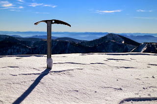
| My ice ax planted on the summit of Mosquito Peak with Stuart Peak right of center. |
I spent less than five minutes on the summit of Mosquito Peak before heading down to my snowshoe, extra gear and trekking pole cache. Upon donning my snowshoes and repacking my gear, I slogged my way up and down the rolling ridges back to Stuart Peak.
~12:45PM: Back on top of Stuart Peak!
It would be untruthful of me to suggest that I was nothing, if not tired, on the second trip up Stuart Peak. I was tired, but no less elated to be out on one of the most beautiful days in recorded history. And, about to walk 8.5 miles downhill! Yahoo!
The trip back to the trail head, although uneventful, was extremely enjoyable and relaxing. I cruised downhill, turning the 2 hour 56 minute ascent into a 2 hour 20 minute descent.
3:17PM: Back at the trail head!
All told, the outing was exactly what I was searching for: an escape from office life and the discovery of winter! I felt and feel incredibly blessed to be afforded opportunities to experience God's beauty and the accompanying peacefulness. I always come back after trips like this a little better than I left. A new creation!
Onward and upward!
Brian
~12:45PM: Back on top of Stuart Peak!
 |
| Self-portrait #3 and final picture of the day on top of Stuart Peak again. Mosquito Peak (form whence I came) is visible over my right shoulder. |
The trip back to the trail head, although uneventful, was extremely enjoyable and relaxing. I cruised downhill, turning the 2 hour 56 minute ascent into a 2 hour 20 minute descent.
3:17PM: Back at the trail head!
All told, the outing was exactly what I was searching for: an escape from office life and the discovery of winter! I felt and feel incredibly blessed to be afforded opportunities to experience God's beauty and the accompanying peacefulness. I always come back after trips like this a little better than I left. A new creation!
Onward and upward!
Brian
